|
|
 |
|||||||||||
|
|
have
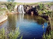
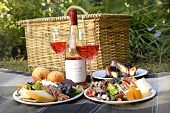
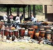
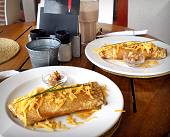
a picnic & |
|
|||||||||
|
|
|||||||||||
|
|||||||||||
|
|||||||||||
|
|
|||||||||||
|
|
|
|
|||||||||
|
|
|||||||||||
|
|
|
|
|||||||||
|
|
|||||||||||
|
|
|
|
|||||||||
|
|
|||||||||||
|
|
|
|
|||||||||
|
|
|||||||||||
|
|
|
|
|||||||||
|
|
|||||||||||
|
|
|
|
|||||||||
|
|
|||||||||||
|
|
|
|
|||||||||
|
|
|||||||||||
 |
|
|
|||||||||
|
|
|||||||||||
|
|
|
 |
|||||||||
|
|
|||||||||||
|
|
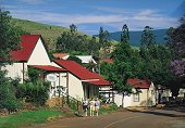
See the Pilgrim's Rest web site for more info |
|
|||||||||
|
|
|||||||||||
|
|
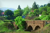
See the Graskop web site for more info |
|
|||||||||
|
|
|||||||||||
|
|
|
|
|||||||||
|
|
|||||||||||
|
|
|
|
|||||||||
|
|
|||||||||||
|
|
|
|||||||||
|
|
|||||||||||
|
|
 |
|||||||||
|
|
|||||||||||
 |
|
|
|||||||||
|
|
|||||||||||
|
|
|
|
|||||||||
|
|
|||||||||||
|
|
|
|
|||||||||
|
|
|||||||||||
|
|
|
|
|||||||||
|
|
|||||||||||
|
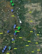
Other Day Trips Close to Hazyview | North of Hazyview | South of Hazyview | East of Hazyview |
|||||||||||
|
|
|||||||||||
|
home
| about | contact
| biodiversity | accommodation | health spas |
cuisine | to do | adventure |
golfing | birding
| shopping | sitemap |
|||||||||||